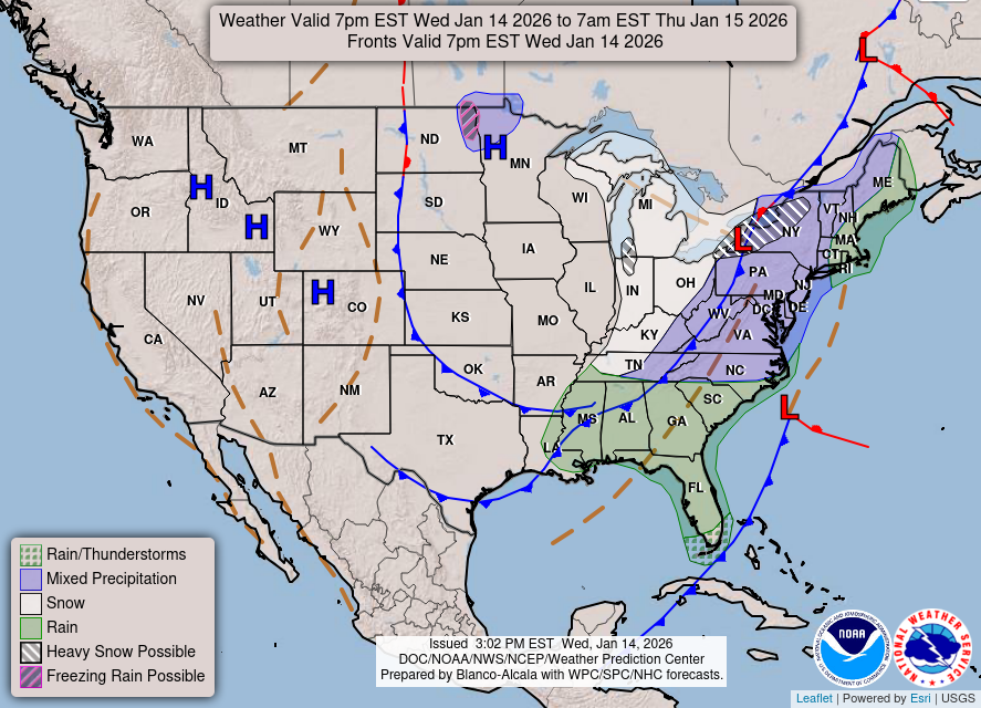
Updated at: 3:06 pm PST Nov 18, 2026 From the NWS Elko, NV.
Tonight
Rain Showers then Scattered Rain And Snow Showers
Lo 23 °F
Thursday
Scattered Snow Showers then Rain And Snow Showers
Hi 42 °F
Thursday Night Areas Of Fog
Lo 22 °F
Friday
Patchy Blowing Snow then Partly Sunny
Hi 37 °F
Friday Night Partly Cloudy
Lo 12 °F
Saturday
Partly Sunny
Hi 35 °F
Saturday Night Mostly Cloudy
Lo 16 °F
Sunday
Scattered Snow Showers
Hi 36 °F
Sunday Night Scattered Snow Showers
Lo 17 °F
Monday
Partly Sunny
Hi 37 °F
Monday Night Mostly Cloudy
Lo 16 °F
Tuesday
Isolated Snow Showers
Hi 37 °F
Tuesday Night Scattered Rain And Snow Showers
Lo 20 °F
Wednesday
Scattered Snow Showers
Hi 41 °F
Tonight
Rain Showers then Scattered Rain And Snow Showers
Lo 23 °F
Rain showers before 1am, then scattered rain and snow showers. Mostly cloudy, with a low around 23. Southeast wind 5 to 15 mph. Chance of precipitation is 90%. New rainfall amounts less than a tenth of an inch possible.
Thursday
Scattered Snow Showers then Rain And Snow Showers
Hi 42 °F
Scattered snow showers before 9am, then rain and snow showers between 9am and 5pm, then patchy fog and rain and snow showers. Mostly cloudy, with a high near 42. South southwest wind 0 to 10 mph. Chance of precipitation is 100%. Little or no snow accumulation expected.
Thursday Night Areas Of Fog
Lo 22 °F
Areas of fog and rain and snow showers before 1am, then snow showers and patchy blowing snow between 1am and 4am, then patchy blowing snow and scattered snow showers. Cloudy, with a low around 22. West wind 5 to 20 mph. Chance of precipitation is 90%. New snow accumulation of 1 to 3 inches possible.
Friday
Patchy Blowing Snow then Partly Sunny
Hi 37 °F
Patchy blowing snow and scattered snow showers before 10am. Partly sunny, with a high near 37. West southwest wind 5 to 20 mph. Chance of precipitation is 50%. New snow accumulation of less than one inch possible.
Friday Night Partly Cloudy
Lo 12 °F
Partly cloudy, with a low around 12. South southwest wind around 5 mph.
Saturday
Partly Sunny
Hi 35 °F
Partly sunny, with a high near 35.
Saturday Night Mostly Cloudy
Lo 16 °F
Mostly cloudy, with a low around 16.
Sunday
Scattered Snow Showers
Hi 36 °F
Scattered snow showers after 10am. Mostly cloudy, with a high near 36. Chance of precipitation is 40%. Little or no snow accumulation expected.
Sunday Night Scattered Snow Showers
Lo 17 °F
Scattered snow showers before 4am. Mostly cloudy, with a low around 17. Chance of precipitation is 40%. New snow accumulation of less than half an inch possible.
Monday
Partly Sunny
Hi 37 °F
Partly sunny, with a high near 37.
Monday Night Mostly Cloudy
Lo 16 °F
Mostly cloudy, with a low around 16.
Tuesday
Isolated Snow Showers
Hi 37 °F
Isolated snow showers between 10am and 4pm, then scattered rain and snow showers. Mostly cloudy, with a high near 37. Chance of precipitation is 40%.
Tuesday Night Scattered Rain And Snow Showers
Lo 20 °F
Scattered rain and snow showers. Mostly cloudy, with a low around 20.
Wednesday
Scattered Snow Showers
Hi 41 °F
Scattered snow showers before 7am, then scattered rain and snow showers between 7am and 4pm, then scattered rain and snow showers between 4pm and 5pm. Mostly cloudy, with a high near 41.


 Home
Forecast
Cams
Records
Radar/Sat
County WX
NW WX
USA WX
Quakes
Rivers
Fires
Air
Sun
Roads
News
Local Info
Links
Site Map
Mobile