The Weather Bark From WeatherFox
Elko Nevada Weather - WeatherFox's Home Den.
Elko Nevada, Elko County & Regional Weather, Cameras, News, & More

Weather Alerts
Issued by the National Weather Service

High Surf Advisory HIGH SURF ADVISORY High Surf Advisory

Areas Affected:
Kings (Brooklyn) - Southwest Suffolk - Southeast Suffolk - Southern Queens - Southern Nassau
Effective: Mon, 8/3 3:08pm Updated: Mon, 8/3 5:20pm Urgency: Expected
Expires: Tue, 8/4 8:00am Severity: Minor Certainty: Likely

 
Details:
* WHAT...For the High Rip Current Risk, dangerous rip currents.
For the High Surf Advisory, large breaking waves of 4 to 8 feet
in the surf zone.

* WHERE...Kings (Brooklyn), Southwest Suffolk, Southeast
Suffolk, Southern Queens and Southern Nassau Counties.

* WHEN...For the High Rip Current Risk, through Tuesday evening.
For the High Surf Advisory, until 9 PM EDT this evening.

* IMPACTS...Dangerous swimming and surfing conditions and
localized beach erosion through this evening. Life-threatening
rip currents are likely for all people entering the surf zone
through Tuesday. Anyone visiting the beaches should stay out of
the surf. Rip currents can sweep even the best swimmers away
from shore into deeper water.

Information:
Inexperienced swimmers should remain out of the water due to
dangerous surf conditions.

If you enter the surf zone, always have a flotation device with
you and swim near a lifeguard. If caught in a rip current, relax
and float, and do not swim against the current. If able, swim in
a direction following the shoreline. If unable to escape, face
the shore and yell or wave for help.

Rip Current Statement RIP CURRENT STATEMENT Rip Current Statement

Areas Affected:
Kings (Brooklyn) - Southwest Suffolk - Southeast Suffolk - Southern Queens - Southern Nassau
Effective: Mon, 8/3 3:08pm Updated: Mon, 8/3 5:20pm Urgency: Expected
Expires: Tue, 8/4 8:00am Severity:  Moderate  Certainty: Likely

 
Details:
* WHAT...For the High Rip Current Risk, dangerous rip currents.
For the High Surf Advisory, large breaking waves of 4 to 8 feet
in the surf zone.

* WHERE...Kings (Brooklyn), Southwest Suffolk, Southeast
Suffolk, Southern Queens and Southern Nassau Counties.

* WHEN...For the High Rip Current Risk, through Tuesday evening.
For the High Surf Advisory, until 9 PM EDT this evening.

* IMPACTS...Dangerous swimming and surfing conditions and
localized beach erosion through this evening. Life-threatening
rip currents are likely for all people entering the surf zone
through Tuesday. Anyone visiting the beaches should stay out of
the surf. Rip currents can sweep even the best swimmers away
from shore into deeper water.

Information:
Inexperienced swimmers should remain out of the water due to
dangerous surf conditions.

If you enter the surf zone, always have a flotation device with
you and swim near a lifeguard. If caught in a rip current, relax
and float, and do not swim against the current. If able, swim in
a direction following the shoreline. If unable to escape, face
the shore and yell or wave for help.

Today's Forecast Map
Click Map To Enlarge & See More Maps
Click Map To Enlarge     Image from NOAA
Current Satellite
Click Map To Enlarge
Click Map To Enlarge     Image from NOAA
Current Weather & Forecasts

Elko    Elko Airport    Ryndon    Spring Creek    Lamoille    Carlin    Adobe Heights    Wild Horse    Mountain City    Owyhee

Ruby Valley    Deeth    Halleck    Wells    Bishop    O'Neil    Jackpot    Palomino Valley    Pequop Summit    Pilot Valley

Loray    Montello    Wendover    Jarbidge    Eureka    Ely    Crescent Valley    Battle Mountain    Tonopah    Winnemucca

Austin    Winnemucca    Reno    Twin Falls    Salt Lake City    Pahrump    Las Vegas    Pendleton    Boise    Portland

Goldstrike Mine    Cortez Mine    Turquoise Ridge Mine    Round Mountain    Seattle    Truckee    Spokane

Forecast Maps    Forecast Discussion

National Weather Service Elko, NV    Climate Prediction Center    Weather Glossary

Alerts provided by the National Weather Service.

Weather Alerts Map
Alerts provided by the National Weather Service.

Weather Alerts Definitions
OUTLOOK
A weather outlook gives you a heads up, there is potential for a significant storm two, three,
four, or perhaps five days in advance. This is your first chance to begin preparing for the event.

SPECIAL WEATHER STATEMENT
A special weather statement may be issued for hazards that have not yet reached
advisory or warning status or that do not have a specific code of their own.

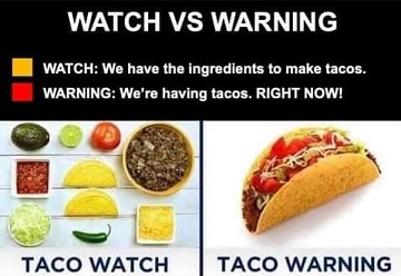
WATCH
A watch is issued a day or two prior to the anticipated significant weather event. Odds of the event
have increased yet some uncertainty remains for the forecast area. Time to get ready, get prepared.

ADVISORY
A advisory is for weather events with up to 24 hour lead time that are more of an inconvenience and
not necessarily life-threatening. A winter weather advisory for one or two inches of snow is an example.

WARNING
A warning means confidence is high the significant weather event will occur within the
next 24 hours or less, or is underway. Time to take action to help save lives and property.

Alerts provided by the National Weather Service.

Current Time    2:26 PM Pacific    3:26 PM Mountain    4:26 PM Central    5:26 PM Eastern    21:26 UTC

Home     Mobile Site     SiteMap     About & Contact

Elko County Facts

15 visitors currently viewing this site.

USA Weather Finder

Home Den Of The World Famous WeatherFox.
Unauthorized duplication or distribution is prohibited.
Copyright © 2003 - 2026 nvwx.com
WeatherFox is a non-meteorologist spokesfox.
Weather forecasts are provided by the National Weather Service.
Weather data from this station is accurate and up to date as possible, equipment failures,
internet issues, weather and/or other conditions may affect the accuracy of the data shown.
Use this and any weather data, forecasts, and images with caution and at your own risk.
Privacy Policy